Navigating by App in the Wilds

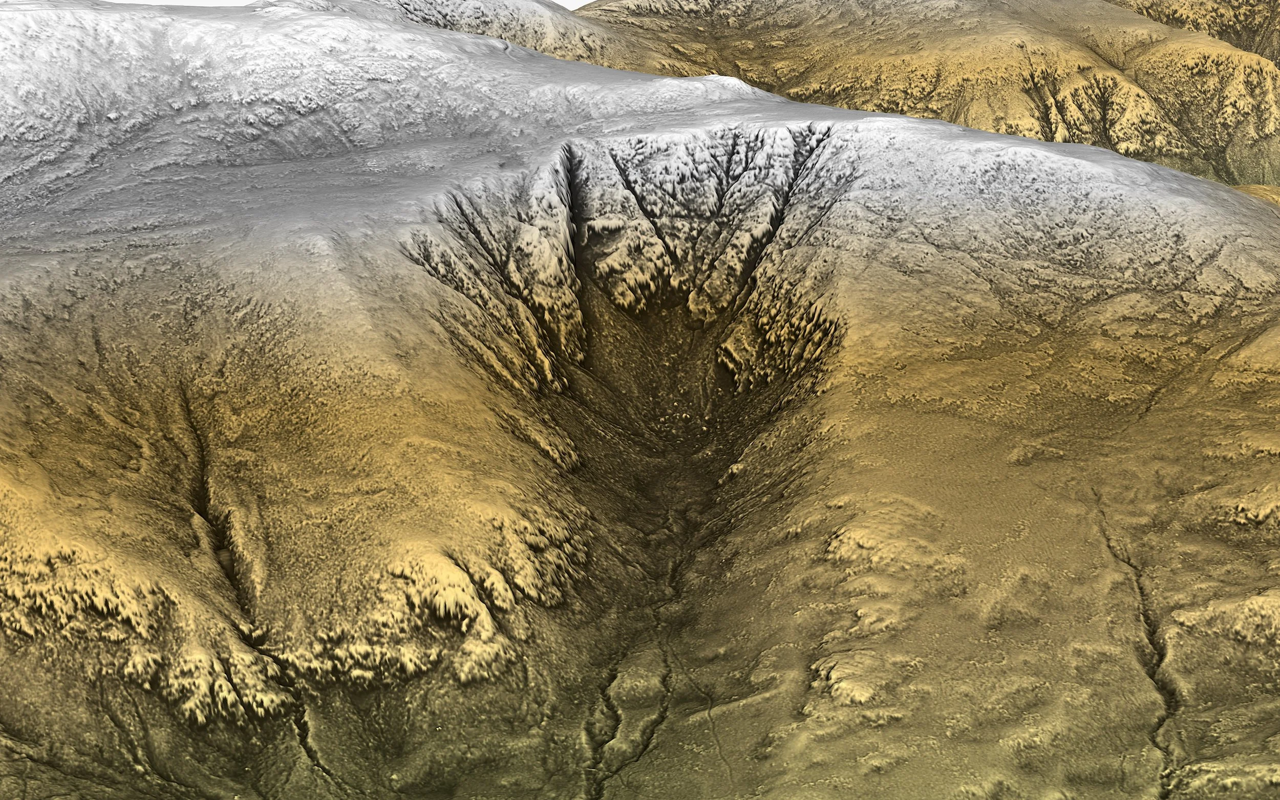
Oblique LiDAR texture-shaded image of Huntington Ravine on Mt. Washington in the New Hampshire White Mountains

Many people are heading out into the wilderness these days intending to rely on their smartphones for navigation. Smartphones have a number of unique advantages over paper maps and analog compasses but, to stay safe, you have to know how to use them as well as understand the situations in which they do not work well (or at all). I put together a series of four 13 minute YouTube videos about navigating by smart phone in the backcountry, based on a presentation that I gave in Summer 2025 at the Cook Library in Tamworth, NH. Click the above line for the full playlist or select individual videos, below:

This video gives an introduction to the 4 part series on how to use hiking apps to navigate safely in the backcountry. After the intro, it explores how location, elevation, and facing (heading) are determined and what problems can arise when your device does not have a full sky view.

Where do digitized trails come from and how do they differ from the actual walked path? Learn how to use topographic slope to determine which trails are right for you and which you should avoid.

This second part of the four part series explores the importance of topographic visualization and the different ways that apps can display topography. We review map tiling schemes and the ways in which paper maps are superior and inferior to digital maps.

In this part we wrap up the series talking about estimating hiking times (route planning), pace, and accessing the weather forecast for the mountain tops. The video ends with a summary of best practices for using apps for hiking.